
- You have no items in your shopping cart
- Subtotal: $0.00
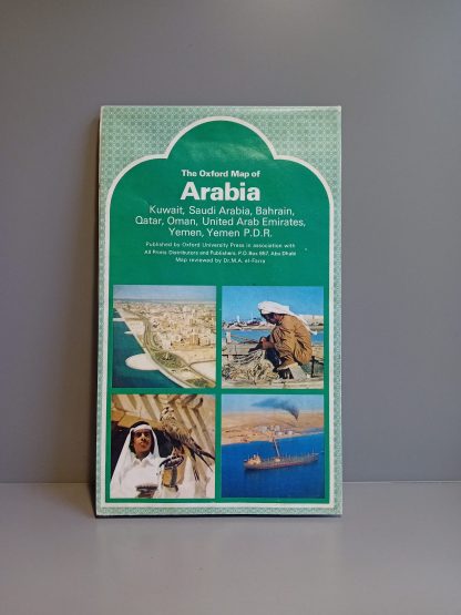
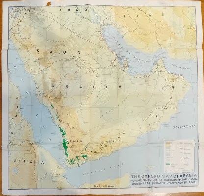
A rare original folding map of the Arabian Peninsula, notable for one of the first detailed regional maps to show the United Arab Emirates after its formation in 1971. Large-format, 88cm x 91cm. Printed on both sides, with one showing the mapped area and another with written profiles of the key countries featured in the coverage, namely Saudi Arabia, Qatar, Bahrain, Kuwait, Oman, the UAE, Yemen, and the Yemen PDR. The map cites oil pipelines and oilfields and uses the term Arabian Gulf for the body of water between the Arab states and Iran. It shows the UAE as being in possession of the Bani Tanb and Tanb e-bozorg disputed islands, and reflects some of the disputed border areas between the Arab Gulf states, for example showing that the UAE borders Qatar directly, a state of affairs that persisted until a 1974 agreement between the UAE and Saudi Arabia was made public in 1995. In clean and bright condition, but with two small torn holes to the top and bottom margins resulting from tape. Published by Oxford University Press in 1976 in association with All Prints Distributors and Publishers in Abu Dhabi. Map reviewed by Dr M. A. el-Farra. Printed in the UK by Cook, Hammond and Kell.
Q & A
There are no questions yet